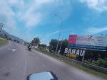
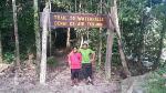
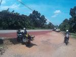
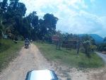
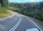
Endau Rompin National Park is a protected 870km2 of tropical rainforest area that spans across 2 states of Pahang and Johor. It got its name from the two main river that flows through the park that are Endau & Rompin River. Gazetted in 1933 and was extended to include Lesong forest reserve about 30 years later, it has 3 main entrances which are from Bekok through Kampung Selai, from Kahang through Kampung Peta and from Kuala Rompin through Kampung Selendang.
This is our third visit to this area after Ride to Pantai Penyabong in 2015 and Ride around Taman Negara Endau Rompin in 2014. Syahril has ridden with me through the first and second ride while this is Yusuf’s first ride with me to Endau-Rompin.
The three of us met in Masjid Batu 14, Hulu Langat and I am 15 minutes late (I am sorry guys!) around 8.15am and we departed right after that. The route looks like this:
We rode towards Sungai Lui and the road was filled with bike enthusiast riding through the morning breeze. It was foggy and very cloudy as my gps couldn’t get any signal in this area. The tarmac was still wet from the last night rain and we rode cautiously in this area. Grip for dual purpose tyres on Syahril and my bike isn’t so great in wet condition.
We continue toward E10 to Bahau, Rompin before making a right turn to Gemas through E1.
We made a quick stop for fuel in Bahau as my bike is not fully filled when we departed this morning.
From there we pushed toward Batu Anam, Segamat and Tenang.
We stopped one more time for petrol at Petronas Labis before making an inbound towards Bekok and Kampung Selai.
We arrived in Bekok around 12.45pm and took lunch at a stall near the park’s office.
I was under the impression that the park's office will be opened at 2pm as promised during my tele-conversation with a park officer about three days ago. However after we finished lunch and returned at exactly 2pm, the office was still closed and we have to wait about 50 minutes before it was reopened.
Taman Negara Endau-Rompin (Selai Office):
GPS Coordinate 2.297550, 103.135065
(Do check out and confirm their office hours as it is not as written on the door)
Registration and payments were quick and we proceed to the campsite, about 26km from the office. However, due to the delay, we couldn’t do the hike to Takah Pandan that day as its getting dark soon.
The route inbound towards the campsite consist of 40% good condition tarmac, 40% damaged tarmac and 20% dirt road.
There are about three major incline/decline along the route but all of it are treated with concrete surface. We arrived at the campsite around 4.15pm.
As we arrived, one of the park staff, Mr. Tali came and briefly explained the campsite do & don’ts.
The campsite facilities are complete with toilet, canteen and musolla. Basic phone line is available here and 500 meters further there is a resort complex with electricity, chalets and dormitories. We camped by the Selai River with crystal clear and cool refreshing water.
Photo Credit to Yusuf Musa
Lubuk Merekek Campsite:
GPS Coordinate 2.43170, 103.25389
Its Syahril’s turn to prepare dinner and he prepared spicy ayam rending with cucumber.
Photo Credit to Yusuf Musa
Photo Credit to Syahril Zulkifli
Photo credit to Yusuf Musa
We had dinner by the campfire and chatted through the night.
Yusuf had prepared a hammock in military camouflage and planned to sleep in it tonight.
Later that night, Yusuf barbequed lamb slices for our late nights and even Syahril’s sleepy eyes are turned fresh from its delicious aroma.
Photo Credit to Syahril Zulkifli
We retrieved to our tents around 11pm and tried to catch a sleep that night.
I was awaken early in the morning from the night’s cold and I did not brought my sleeping bag. Lucky I have my sarong to be used as a blanket that night.
Photo Credit to Yusuf Musa
I was up around 6.30am and after morning prayer, I prepared breakfast for the trio. We had fried mee with tomatoes and egg.
Photo Credit to Syahril Zulkifli
Yesterday, we had arranged to have the hiking session at 8.30am and our guide, Mr. Pak Yong was punctual. He is one of the local guide appointed by the park to guide us to the nearest waterfall, Takah Pandan about 30 minutes away (according to him).
Photo Credit to Syahril Zulkifli
We started hiking around 8.35am towards Lubuk Tapah and we took a lot of pictures.
Photo Credit to Syahril Zulkifli
It started to climb and our pace dropped. Although fully equipped with rope, the hike was very steep and high.
We took slightly over an hour to get to the waterfall complex. It consists of a few smaller water cascading down before you will get to the actual Takah Pandan. This the very first waterfall we met.
Photo credit to Yusuf Musa
Takah Pandan (Endau Rompin National Park)
Syahril and I took a dip in the icy cold and clear water. We spend about an hour at the fall before headed back to campsite.
Along the route, Pak Yong filled us with his life-experiences and the jungle’s insider. He keep referring the jungle as their “Kebun” instead of a jungle or park.
Photo credit to Syahril Zulkifli
A few big logs are available along the route as Pak Yong took us through Arboretum (botanical garden) route.
Photo credit to Syahril Zulkifli
We took slightly over 30 minutes to get back to campsite, clean ourselves and pack our stuff.
We leave the site around 12.50pm and took our bike to Lubuk Tapah for more pictures.
We went out from the site and heads back to Bekok & Labis.
We refueled and increase tyre pressure in Caltex Labis.
Right after Masjid Labis, we turned left towards Bukit Kepong thorugh J32 and towards Sagil through J34 and E23.
We turned left before Tangkak through J123 Bekoh and Jalan Bukit Senggeh towards Nyalas.
We made a stopped in Tangkak for lunch and we had Durian and mangosteen!
We had baby musang king, lion king and god knows what king!
Photo credit to Syahril Zulkifli
Around 4.30pm, we made a stop in Petronas Gemencheh for fuel & some refreshments
We passed through Dangi and Selaru before turning left in Senaling towards Seri Menanti and Senawang.
Village road in Pilah is very beautiful and serene with a lot traditional minang houses by the road side.
We made a quick stop in Seri Menanti museum but it is closed for maintenance.
We continue towards Bukit Putus, Senawang and finally Lekas highway.
The highest altitude achieved throughout the ride to home is achieve here, near Gunung Angsi trail.
Our final stop is after Kajang Selatan toll and we said goodbye to each other here.
It has been a very adventurous ride for me as I ride, hike and swim in one overnight trip. The park is also very beautiful and I may return in the future.
In my view, one let down of this ride in particular is the lack of offroading section as most of the road leading into the campsite is treated.
Being close to nature is a blessing for all of us and it is hoped that the pristine condition could last for the future. Billions of thanks to Sahril & Yusuf for joining me in this trip and you guys are truly awesome!
Ride snippets:
Rider:
Shahril Zulkifli V650
Yusuf Musa F800
Myself V650
***********Originally posted on myridinguniverse.blogspot.com**********************************************
This is our third visit to this area after Ride to Pantai Penyabong in 2015 and Ride around Taman Negara Endau Rompin in 2014. Syahril has ridden with me through the first and second ride while this is Yusuf’s first ride with me to Endau-Rompin.
The three of us met in Masjid Batu 14, Hulu Langat and I am 15 minutes late (I am sorry guys!) around 8.15am and we departed right after that. The route looks like this:
We rode towards Sungai Lui and the road was filled with bike enthusiast riding through the morning breeze. It was foggy and very cloudy as my gps couldn’t get any signal in this area. The tarmac was still wet from the last night rain and we rode cautiously in this area. Grip for dual purpose tyres on Syahril and my bike isn’t so great in wet condition.
We continue toward E10 to Bahau, Rompin before making a right turn to Gemas through E1.
We made a quick stop for fuel in Bahau as my bike is not fully filled when we departed this morning.
From there we pushed toward Batu Anam, Segamat and Tenang.
We stopped one more time for petrol at Petronas Labis before making an inbound towards Bekok and Kampung Selai.
We arrived in Bekok around 12.45pm and took lunch at a stall near the park’s office.
I was under the impression that the park's office will be opened at 2pm as promised during my tele-conversation with a park officer about three days ago. However after we finished lunch and returned at exactly 2pm, the office was still closed and we have to wait about 50 minutes before it was reopened.
Taman Negara Endau-Rompin (Selai Office):
GPS Coordinate 2.297550, 103.135065
(Do check out and confirm their office hours as it is not as written on the door)
Registration and payments were quick and we proceed to the campsite, about 26km from the office. However, due to the delay, we couldn’t do the hike to Takah Pandan that day as its getting dark soon.
The route inbound towards the campsite consist of 40% good condition tarmac, 40% damaged tarmac and 20% dirt road.
There are about three major incline/decline along the route but all of it are treated with concrete surface. We arrived at the campsite around 4.15pm.
As we arrived, one of the park staff, Mr. Tali came and briefly explained the campsite do & don’ts.
The campsite facilities are complete with toilet, canteen and musolla. Basic phone line is available here and 500 meters further there is a resort complex with electricity, chalets and dormitories. We camped by the Selai River with crystal clear and cool refreshing water.
Photo Credit to Yusuf Musa
Lubuk Merekek Campsite:
GPS Coordinate 2.43170, 103.25389
Its Syahril’s turn to prepare dinner and he prepared spicy ayam rending with cucumber.
Photo Credit to Yusuf Musa
Photo Credit to Syahril Zulkifli
Photo credit to Yusuf Musa
We had dinner by the campfire and chatted through the night.
Yusuf had prepared a hammock in military camouflage and planned to sleep in it tonight.
Later that night, Yusuf barbequed lamb slices for our late nights and even Syahril’s sleepy eyes are turned fresh from its delicious aroma.
Photo Credit to Syahril Zulkifli
We retrieved to our tents around 11pm and tried to catch a sleep that night.
I was awaken early in the morning from the night’s cold and I did not brought my sleeping bag. Lucky I have my sarong to be used as a blanket that night.
Photo Credit to Yusuf Musa
I was up around 6.30am and after morning prayer, I prepared breakfast for the trio. We had fried mee with tomatoes and egg.
Photo Credit to Syahril Zulkifli
Yesterday, we had arranged to have the hiking session at 8.30am and our guide, Mr. Pak Yong was punctual. He is one of the local guide appointed by the park to guide us to the nearest waterfall, Takah Pandan about 30 minutes away (according to him).
Photo Credit to Syahril Zulkifli
We started hiking around 8.35am towards Lubuk Tapah and we took a lot of pictures.
Photo Credit to Syahril Zulkifli
the awesome trio
Photo Credit to Syahril Zulkifli
It started to climb and our pace dropped. Although fully equipped with rope, the hike was very steep and high.
We took slightly over an hour to get to the waterfall complex. It consists of a few smaller water cascading down before you will get to the actual Takah Pandan. This the very first waterfall we met.
Photo credit to Yusuf Musa
Takah Pandan (Endau Rompin National Park)
Syahril and I took a dip in the icy cold and clear water. We spend about an hour at the fall before headed back to campsite.
Along the route, Pak Yong filled us with his life-experiences and the jungle’s insider. He keep referring the jungle as their “Kebun” instead of a jungle or park.
Photo credit to Syahril Zulkifli
A few big logs are available along the route as Pak Yong took us through Arboretum (botanical garden) route.
Photo credit to Syahril Zulkifli
We took slightly over 30 minutes to get back to campsite, clean ourselves and pack our stuff.
We leave the site around 12.50pm and took our bike to Lubuk Tapah for more pictures.
We went out from the site and heads back to Bekok & Labis.
We refueled and increase tyre pressure in Caltex Labis.
Right after Masjid Labis, we turned left towards Bukit Kepong thorugh J32 and towards Sagil through J34 and E23.
We turned left before Tangkak through J123 Bekoh and Jalan Bukit Senggeh towards Nyalas.
We made a stopped in Tangkak for lunch and we had Durian and mangosteen!
We had baby musang king, lion king and god knows what king!
Photo credit to Syahril Zulkifli
Around 4.30pm, we made a stop in Petronas Gemencheh for fuel & some refreshments
We passed through Dangi and Selaru before turning left in Senaling towards Seri Menanti and Senawang.
Village road in Pilah is very beautiful and serene with a lot traditional minang houses by the road side.
We made a quick stop in Seri Menanti museum but it is closed for maintenance.
We continue towards Bukit Putus, Senawang and finally Lekas highway.
The highest altitude achieved throughout the ride to home is achieve here, near Gunung Angsi trail.
Our final stop is after Kajang Selatan toll and we said goodbye to each other here.
It has been a very adventurous ride for me as I ride, hike and swim in one overnight trip. The park is also very beautiful and I may return in the future.
In my view, one let down of this ride in particular is the lack of offroading section as most of the road leading into the campsite is treated.
Being close to nature is a blessing for all of us and it is hoped that the pristine condition could last for the future. Billions of thanks to Sahril & Yusuf for joining me in this trip and you guys are truly awesome!
Ride snippets:
Rider:
Shahril Zulkifli V650
Yusuf Musa F800
Myself V650
***********Originally posted on myridinguniverse.blogspot.com**********************************************
Attachments
-
map%2B1.png80 KB · Views: 221
-
DSC_1661.jpg51 KB · Views: 243
-
DSC_1659.jpg39.9 KB · Views: 225
-
2014_0101_001713_031.jpg37.8 KB · Views: 233
-
2014_0101_012838_863.jpg25.1 KB · Views: 211
-
2014_0101_012720_848.jpg34.4 KB · Views: 218
-
2014_0101_011010_648.jpg59.1 KB · Views: 237
-
2014_0101_010838_630.jpg40.5 KB · Views: 209
-
2014_0101_001703_029.jpg35.2 KB · Views: 205
-
2014_0101_002055_074.jpg34.9 KB · Views: 201
-
DSC_1669.jpg67 KB · Views: 174
-
WhatsApp%2BImage%2B2016-08-15%2Bat%2B1.52.08%2BPM.jpg63.4 KB · Views: 153
-
WhatsApp%2BImage%2B2016-08-15%2Bat%2B1.52.05%2BPM.jpg12.6 KB · Views: 168
-
WhatsApp%2BImage%2B2016-08-15%2Bat%2B1.37.08%2BPM.jpg15.7 KB · Views: 193
-
IMG-20160814-WA0074.jpg68 KB · Views: 157
-
DSC_1668.jpg58.2 KB · Views: 166
-
IMG-20160814-WA0069.jpg80 KB · Views: 164
-
IMG-20160814-WA0070.jpg72.2 KB · Views: 183
-
2014_0101_013056_376.jpg55.6 KB · Views: 164
-
2014_0101_012956_357.jpg59.2 KB · Views: 164
-
2014_0101_012809_323.jpg57.2 KB · Views: 169
-
2014_0101_012703_302.jpg64.6 KB · Views: 171
-
DSC_1663.jpg68.3 KB · Views: 173
-
DSC_1679.jpg42.2 KB · Views: 155
-
IMG-20160814-WA0058.jpg71.8 KB · Views: 164
-
IMG-20160814-WA0060.jpg69.7 KB · Views: 178
-
IMG-20160814-WA0064.jpg81.7 KB · Views: 160
-
DSC_1681.jpg51.5 KB · Views: 162
-
IMG-20160814-WA0075.jpg62.6 KB · Views: 165
-
IMG-20160814-WA0068.jpg38.5 KB · Views: 185
-
WhatsApp%2BImage%2B2016-08-15%2Bat%2B1.52.07%2BPM.jpg32.3 KB · Views: 157
-
13923597_10210441734944982_1470348960187223379_o.jpg77.7 KB · Views: 177
-
DSC_1672.jpg15 KB · Views: 188
-
DSC_1677.jpg26.6 KB · Views: 167
-
DSC_1673.jpg16.9 KB · Views: 182
-
IMG-20160814-WA0061.jpg23.6 KB · Views: 152
-
DSC_1714.jpg68 KB · Views: 175
-
DSC_1725.jpg64.2 KB · Views: 165
-
DSC_1726.jpg45.9 KB · Views: 166
-
IMG-20160814-WA0055.jpg82.7 KB · Views: 185
-
IMG-20160814-WA0044.jpg62.9 KB · Views: 165
-
DSC_1683.jpg69.6 KB · Views: 174
-
DSC_1690.jpg77 KB · Views: 188
-
DSC_1707.jpg82.3 KB · Views: 152
-
13925954_10210442322559672_3358522211380110360_o.jpg14.2 KB · Views: 140
-
DSC_1695.jpg70.9 KB · Views: 163
-
DSC_1703.jpg61.1 KB · Views: 168
-
13996094_10210442324679725_5957460247436635005_o.jpg37.5 KB · Views: 151
-
DSC_1678.jpg67.7 KB · Views: 147
-
2014_0101_231046_054.jpg58.8 KB · Views: 137
-
2014_0101_230944_042.jpg62.6 KB · Views: 138
-
2014_0101_231137_064.jpg71.9 KB · Views: 142
-
2014_0101_231605_116.jpg47.7 KB · Views: 138
-
2014_0101_231610_117.jpg56 KB · Views: 137
-
2014_0101_230918_037.jpg69.6 KB · Views: 147
-
DSC_1719.jpg70.3 KB · Views: 122
-
13920415_10210442328759827_2692759850968334229_o.jpg65.8 KB · Views: 143
-
DSC_1731.jpg55.3 KB · Views: 125
-
2014_0101_230908_035.jpg69.3 KB · Views: 140
-
map%2B3.png77.6 KB · Views: 157
-
IMG-20160814-WA0038.jpg47.5 KB · Views: 134
-
2014_0102_004459_1152.jpg47.7 KB · Views: 128
-
2014_0102_003859_1082.jpg51.9 KB · Views: 134
-
IMG-20160814-WA0039.jpg41.2 KB · Views: 136
-
IMG-20160814-WA0040.jpg54.6 KB · Views: 159
-
IMG-20160814-WA0043.jpg36.9 KB · Views: 126
-
2014_0102_003309_1014.jpg37.8 KB · Views: 121
-
2014_0101_231809_140.jpg67 KB · Views: 150
-
2014_0101_232012_164.jpg68.1 KB · Views: 119
-
2014_0101_232124_178.jpg47.9 KB · Views: 129
-
2014_0102_002103_873.jpg59.6 KB · Views: 122
-
2014_0102_000729_715.jpg42.4 KB · Views: 159
-
2014_0102_035546_326.jpg39.1 KB · Views: 126
-
2014_0102_035415_317.jpg51.2 KB · Views: 156
-
2014_0102_032923_170.jpg41.3 KB · Views: 142
-
DSC_1736.jpg37.7 KB · Views: 127
-
2014_0102_041654_451.jpg46.5 KB · Views: 128
-
2014_0102_043430_555.jpg25.7 KB · Views: 136
-
2014_0102_032912_169.jpg40.7 KB · Views: 131
-
IMG-20160814-WA0045.jpg35.2 KB · Views: 153
-
2014_0102_030632_035.jpg32 KB · Views: 126
-
2014_0102_032216_128.jpg43.5 KB · Views: 152
-
2014_0102_032842_166.jpg43.8 KB · Views: 119
-
2014_0102_032902_168.jpg39.3 KB · Views: 145
-
2014_0102_032852_167.jpg42.3 KB · Views: 127
-
map%2B4.png19.8 KB · Views: 127
-
2014_0102_043753_575.jpg35.3 KB · Views: 131
-
DSC_1724.jpg67.6 KB · Views: 159
Last edited: