KANTHARALAK TO CHONG MEK, VIA PRASAT PREAH VIHEAR TEMPLE AND THE EMERALD TRIANGLE.
There’s a lot of ways of spelling the temples name, I’ll go with the Lonely Planets.
I was heading to the Laos border at Chong Mek from Kantharalak and decided to take a long cut, and see if the temple that the Thais and Cambodians have been fighting over had been reopened on the Thai side. And also to have a look at what’s known as the Emerald Triangle, which is were Thailand, Laos and Cambodia all meet.
Early morning start in Kantharlak, were the bed bugs are the size of mice, and the main street is a drag strip for young guys with tricked up two stokes to race each other.
From Kantharalak I headed south on HWY 221 to the Prasat Preah Vihear Temple.
Kantharlaks big white temple.
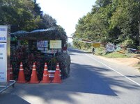
The check point, and entry to the Khao Phra Wihan (Thai English spelling) National Park, were I was told that entry to the park was ok, but the temple itself was closed.
Thought I may as well go have look anyway.
About 8kms from the check point you get to were all the action is.
This cliff is the Thai-Cambodian border.
Looking into Cambodia.
You can see a building in the back ground of this photo. This is part of the main bunker and view point, were the Thai army keeps an eye on Cambodians. Photos are not allowed.
There was about 10 soldiers in the bunker, and at all times, there was at least one looking towards the temple. But I didn’t see one gun, maybe because the last shoot out was started because someone accidently let a round off, which resulted in an all out fire fight .
One of the army guys let me use he’s binoculars so I could see what the enemy was up too.
I put the camera to the binoculars and took a shot. I would have liked to taken more photos of the bunkers and surrounding area, but this was not allowed.
Please stay on the trail. But that barbed wire looks so inviting.
It’s not the gateway at the moment, but hopefully in the future they’ll sort out there problems.
After leaving the National Park, I rode along HWY 2248 until reaching the turn off to the Emerald Triangle, from there its about 12kms on a good road, that doesn’t look like it gets much use.
There was an army camp near the turn off, and I didn’t see a sole till I noticed one soldier at a small out post at the triangle itself.
The road ends at a small lake.
There’s no going any further, so the Golden Triangle Rider is now an Emerald Triangle Rider as well.
This was at the entrance to the small army out post at the Triangle. Maybe someone can translate it.
From the Emerald Triangle I headed up the road to Chong Mek, the city were the out of tune sounds of karaoke start early, and never seem finish.
Moto-Rex
Attachments
-
Prasat-Preah-Vihear-Temple4.jpg7 KB · Views: 187
-
Prasat-Preah-Vihear-Temple5.jpg7 KB · Views: 211
-
Prasat-Preah-Vihear-Temple6.jpg7 KB · Views: 183
-
Prasat-Preah-Vihear-Temple7.jpg7 KB · Views: 209
-
Prasat-Preah-Vihear-Temple8.jpg7 KB · Views: 191
-
Prasat-Preah-Vihear-Temple9.jpg7 KB · Views: 180
-
Prasat-Preah-Vihear-Temple10.jpg7 KB · Views: 191
-
Prasat-Preah-Vihear-Temple11.jpg7 KB · Views: 177
-
Prasat-Preah-Vihear-Temple14.jpg7 KB · Views: 185
-
Prasat-Preah-Vihear-Temple15.jpg7 KB · Views: 198
-
DSCF2510.jpg7 KB · Views: 184
-
Prasat-Preah-Vihear-Temple13.jpg7 KB · Views: 190
-
Prasat-Preah-Vihear-Temple12.jpg7 KB · Views: 181
-
Prasat Preah Vihear Temple (11).JPG455.3 KB · Views: 176
Last edited: