Caution: Very Steep/Dangerous Road Collapse/ Restricted Area Dangerous Road

Oct 5, 2012
19
2
0
I did this trip today. Since the Thai army will not allow me to pass their checkpoint just near the Shan State Army camp on Doi 30 (Loi 30 in Shan) I decided to do it the other way around and try to sneak into the camp before getting to their barrier. I have been unable to visit the kids there for more than a year now, and have known many of them for over four years since my first trip there.
http://www.flickr.com/photos/28361002@N07/sets/72157614289584950/
http://www.flickr.com/photos/28361002@N07/sets/72157614806955662/
http://www.flickr.com/photos/28361002@N07/sets/72157616439816368/

I rode my trusty Honda Wave from Fang to the start of the Doi Laem Loop before Mae Ai and started on the loop clockwise. Dropped in at a Black Lahu village to hand out lollipops to the kids, then rode through the Red Lahu village alongside the main road doing the same (I am notorious for handing out toothaches..)
http://www.flickr.com/photos/28361002@N07/sets/72157636181667426/

Once I got to the turn off left I saw a big barrier but it only went halfway across the road and was unmanned...probably the soldiers were in their huts nearby , so i just rode past and started my adventure. The road surface was quite rutted and washed away in many places on the climb, but nothing too difficult, so easy for an off-road bike. I have never ridden an off-road bike and don't really like loose stuff, but I managed OK.
I passed a couple of Army/Police guys at a hutment a couple of Km. before reaching the place where the road had been repaired, and after a quick chat carried on. They said there were three of them living there and never seemed surprised to see me or made me feel they were 'letting' me go past. They just assumed I was going for a ride. I said a farang had posted that the road was repaired and that I wanted to see for myself and take some photos.
The repaired road is just gravel but no problem. Looking at the earlier photos in this thread showing how it was I know I'd never have the bottle to try going past. My last trip was going clockwise about 12 or 13 years ago before the road collapsed....on my Honda Steed...(so perhaps I caused it! lol).

I popped into the S.S.A. camp to visit the kids and then carried on. The Thai army post stopped me for a while. Checking my bags and taking down details of my driving licence. They also phoned their base, which is down near the entrance to the Orange plantation headquarters by the dam on the reservoir, asking if it was OK to let a foreigner pass. (I was thinking ...surely they aren't going to make me go all the way back the way I came....I doubt if I would have had enough petrol for it anyway, and I had already past the most sensitive areas that they are concerned about.
Then on down and back to Fang.

I recorded the trip on my smartphone with the GPS tracker app so i have the gpx file and the kmz one for Google Earth. Not sure if I can upload them here or not.
 
  • Like
Reactions: Eoin Christie
Oct 5, 2012
19
2
0
yes but I didn't start at ThaTon. You can see the Doi laem loop and I left it at the top going to join yours '

does your name mean you were in the BSAC ...I was too..
 
Dec 21, 2012
73
3
0
Now i understand, yes i was in BSAC for many years, most people think i made a spelling mistake and it should be BSABOB ;)
 

DavidFL

0
Staff member
Subscribed
Jan 16, 2003
14,811
5,619
113
70
Chiang Khong
www.thegtrider.com
fabianfred;293455 wrote: I did this trip today. Since the Thai army will not allow me to pass their checkpoint just near the Shan State Army camp on Doi 30 (Loi 30 in Shan) I decided to do it the other way around and try to sneak into the camp before getting to their barrier. I have been unable to visit the kids there for more than a year now, and have known many of them for over four years since my first trip there.
http://www.flickr.com/photos/28361002@N07/sets/72157614289584950/
http://www.flickr.com/photos/28361002@N07/sets/72157614806955662/
http://www.flickr.com/photos/28361002@N07/sets/72157616439816368/

I rode my trusty Honda Wave from Fang to the start of the Doi Laem Loop before Mae Ai and started on the loop clockwise. Dropped in at a Black Lahu village to hand out lollipops to the kids, then rode through the Red Lahu village alongside the main road doing the same (I am notorious for handing out toothaches..)
http://www.flickr.com/photos/28361002@N07/sets/72157636181667426/

Once I got to the turn off left I saw a big barrier but it only went halfway across the road and was unmanned...probably the soldiers were in their huts nearby , so i just rode past and started my adventure. The road surface was quite rutted and washed away in many places on the climb, but nothing too difficult, so easy for an off-road bike. I have never ridden an off-road bike and don't really like loose stuff, but I managed OK.
I passed a couple of Army/Police guys at a hutment a couple of Km. before reaching the place where the road had been repaired, and after a quick chat carried on. They said there were three of them living there and never seemed surprised to see me or made me feel they were 'letting' me go past. They just assumed I was going for a ride. I said a farang had posted that the road was repaired and that I wanted to see for myself and take some photos.
The repaired road is just gravel but no problem. Looking at the earlier photos in this thread showing how it was I know I'd never have the bottle to try going past. My last trip was going clockwise about 12 or 13 years ago before the road collapsed....on my Honda Steed...(so perhaps I caused it! lol).

I popped into the S.S.A. camp to visit the kids and then carried on. The Thai army post stopped me for a while. Checking my bags and taking down details of my driving licence. They also phoned their base, which is down near the entrance to the Orange plantation headquarters by the dam on the reservoir, asking if it was OK to let a foreigner pass. (I was thinking ...surely they aren't going to make me go all the way back the way I came....I doubt if I would have had enough petrol for it anyway, and I had already past the most sensitive areas that they are concerned about.
Then on down and back to Fang.

I recorded the trip on my smartphone with the GPS tracker app so i have the gpx file and the kmz one for Google Earth. Not sure if I can upload them here or not.
Hey there Fred, the link
http://www.flickr.com/photos/28361002@N07/3300118545/in/set-72157614289584950/
to the first batch of photos.
What was the event - night time, where?
Shan - Lisu - Palong?

It must have been a bit chilly up there. Did you spend the night there or come back down in the dark?
 
Oct 5, 2012
19
2
0
That first trip David was done with a party of monks and novices and some other farangs and Thai students. We went in vehicles and stayed one night most camping in tents. Next day gave out many things like clothing and snacks and organised games too. That night they put on a show for us.
Mostly Shan then, but also there was the Lisu village of 20 houses nearby, and some Palaung living in the houses in the area too.
Now there are mostly Shan...the Lisu village has gone, and the Palaung have gone too.
The ground is dusty and is home to some biting insects which result in a week of itching (just get bitten up to ankle level)...even my short stay there yesterday got me a couple of bites. I suppose the residents become immune to it.

some later trips I made there....

http://www.flickr.com/photos/28361002@N07/sets/72157629234279971/

http://www.flickr.com/photos/28361002@N07/sets/72157629542290044/
 
  • Like
Reactions: Eoin Christie

Tarquin Ferrets

Active Member
Feb 4, 2019
40
47
18
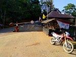
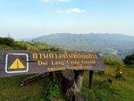
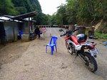
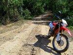
About a week ago I attempted this border road around Doi Phahom Pok. I heard reports that the road is closed, however, as I was riding the highway 1314 Doi Lam loop for fun I decided to try my luck. The paramilitary guys at the 1314 end check-point interviewed me why I wanted to enter that road and for some reason were concerned if I continue to Doi Angkhang as well. After explaining that I had no intentions to continue to Doi Angkhang just wanted another scenic border route back to Fang they decided to let me go on it. After they recorded my bike's license number and my information from driver's license I was on my way. I thought to myself 'yehey it's open' and pressed on with a smile on my face. Not so fast, nice try no cigar. After about 21 km I ran into another foreigner doing photography in the area who explained the road has been closed for years, but I could try my luck with the check-point just up the road. Sure enough there was a Border Patrol Police check-point and the road was closed. He explained to me that even if he let's me through there's another check-point manned by the Thai Army and they will not let me pass. On top of that he said he would get an earful for letting me through. He told me they were proper military, Cavalry from Saraburi with orders, and won't negotiate. So there was no chance getting through. But the Border Patrol Policeman sure was happy to see me so we drank some tea together and had 15 minute chat. He confirmed it's still a bit mixed bag across the border with few Shan State Army - South camps (including the Shan IDP camp) but majority was under United Wa State Army control. Not far across the border where he had his post is a 200-300 strong UWSA camp. He told me it's a one boring and lonely spot especially at night even though the Wa hasn't caused any issues in a long time. Apparently they do 5 day shifts manning that post. He seemed to be alone but referred to his partner being somewhere so I assume they man it in pairs. So the road is still closed but you can do approximately 22 km from highway 1314 check-point. The views to Burma are not really worth it as most is blocked by trees and vegetation (unless you dismount your bike and look for a spot).
Screenshot_20190131-175705.png
Screenshot_20190131-175705.png 1-IMG_20190131_162454.jpg 1-IMG_20190131_153411.jpg 1-IMG_20190131_150306.jpg 1-IMG_20190131_141556.jpg Screenshot_20190131-175705.png
1-IMG_20190131_162454.jpg
1-IMG_20190131_153411.jpg
1-IMG_20190131_150306.jpg
1-IMG_20190131_141556.jpg
 

DavidFL

0
Staff member
Subscribed
Jan 16, 2003
14,811
5,619
113
70
Chiang Khong
www.thegtrider.com
About a week ago I attempted this border road around Doi Phahom Pok. I heard reports that the road is closed, however, as I was riding the highway 1314 Doi Lam loop for fun I decided to try my luck. The paramilitary guys at the 1314 end check-point interviewed me why I wanted to enter that road and for some reason were concerned if I continue to Doi Angkhang as well. After explaining that I had no intentions to continue to Doi Angkhang just wanted another scenic border route back to Fang they decided to let me go on it. After they recorded my bike's license number and my information from driver's license I was on my way. I thought to myself 'yehey it's open' and pressed on with a smile on my face. Not so fast, nice try no cigar. After about 21 km I ran into another foreigner doing photography in the area who explained the road has been closed for years, but I could try my luck with the check-point just up the road. Sure enough there was a Border Patrol Police check-point and the road was closed. He explained to me that even if he let's me through there's another check-point manned by the Thai Army and they will not let me pass. On top of that he said he would get an earful for letting me through. He told me they were proper military, Cavalry from Saraburi with orders, and won't negotiate. So there was no chance getting through. But the Border Patrol Policeman sure was happy to see me so we drank some tea together and had 15 minute chat. He confirmed it's still a bit mixed bag across the border with few Shan State Army - South camps (including the Shan IDP camp) but majority was under United Wa State Army control. Not far across the border where he had his post is a 200-300 strong UWSA camp. He told me it's a one boring and lonely spot especially at night even though the Wa hasn't caused any issues in a long time. Apparently they do 5 day shifts manning that post. He seemed to be alone but referred to his partner being somewhere so I assume they man it in pairs. So the road is still closed but you can do approximately 22 km from highway 1314 check-point. The views to Burma are not really worth it as most is blocked by trees and vegetation (unless you dismount your bike and look for a spot).View attachment 127795 View attachment 127795 View attachment 127795 View attachment 127796 View attachment 127797 View attachment 127798 View attachment 127799 View attachment 127795 View attachment 127796 View attachment 127797 View attachment 127798 View attachment 127798 View attachment 127799

Fantastic update. Many thanks
 

Oddvar

0
Subscribed
Mar 18, 2013
538
365
63
Per and I did this loop in 2013. Can not find any pictures except for the GPX file. I do remember there was a lot of check points, but Per, in his perfect Thai, sweet talked us through them all.
I will ask Tom, who built a mountain cabin up there, if he knows anything about riding through there.
Screenshot 2019-02-09_10-38-04-069.png
 

Tarquin Ferrets

Active Member
Feb 4, 2019
40
47
18
Per and I did this loop in 2013. Can not find any pictures except for the GPX file. I do remember there was a lot of check points, but Per, in his perfect Thai, sweet talked us through them all.
I will ask Tom, who built a mountain cabin up there, if he knows anything about riding through there.
View attachment 127800

Would be great if we could safely ride through the whole birder loop. I did sweet talk the paramilitary guys and could have probably done the same with the border patrol policeman. However, the next check point is proper permanent military and apparently no chance. And military is still currently in power in Thailand - that could have something to do with it as well. Back in 2013 was still civilian rule. There foreigner I met doing photography along the road also confirmed it's been closed for several years. Anyway, if anyone manages to get through the whole border loop gis us an update
 

ianyonok

0
Subscribed
Dec 9, 2008
1,082
868
113
There have been some other threads about this amazing road, but this one has some of the best info, particularly from Rod Page about the White Chedi. It certainly is one of the most interesting roads in the north.
From David's 1st Edition 2008 map. The missing portion of the road, north of Pahampok, is shown "Dangeroud Road Collapse".
2019-11-23 09.28.46.jpg


I did ride the full loop with GarySharpeyes in 2011, when the road was broken, but you could just walk bikes across.
Pahampok 13.jpg
Pahampok 14.jpg


Then I rode it again in 2013 with Ron Webb, after the broken section was repaired.
2013-03-13 11.51.28.jpg


As far as I am aware, since then, this full border road around the back of Doi Pahampok was closed, after the last army coup and it has only been possible to ride the short Doi Larng / Doi Laem loop at the eastern end.

But, I was up the there yesterday at the Pang San Krua checkpoint, at the eastern end of the loop. After a chat with the soldier, he said we could go up the road and camp for the night, 17klms further on at a campsite. He said it was quite safe to camp the night, no border troubles up there any more.

So, we headed up the border road. However, we only got 1.5klms and realised that we were simply on the wrong bikes. The road condition has also deteriorated signifiicantly since I last rode it. There is a lot of broken tarmac on the first section up to the border.
2019-11-21 15.17.15-1.jpg

This photo above, does not show how steep the road is.
Nigel and I ended up walking and paddling our heavy road bikes back down 1.5klms of the broken tarmac and dirt road with lots of loose gravel.

So, back down the loop we found a place to camp on the ridge road near Pang Ton Kong.
2019-11-21 17.02.16-1.jpg


Steep broken tarmac and dirt roads are not the place for a 50 year old cafe racer.... or a modern street bike.
2019-11-21 17.05.19.jpg


But it was a nice place to camp, with views down to the 107 and Mae Ai.
2019-11-21 21.16.00.jpg
2019-11-22 06.41.50.jpg


But, I have the urge to return and try again for the old border road on a more suitable bike. Certainly I would love to find "The White Chedi". There were small bikes on the road and the soldier had said 2 other people were riding round the full border loop.